4 Chapter 2.2 – Digital Terrain Model
Overview
Once the 3D dense cloud is generated, the next step is to create an accurate digital elevation model (DEM), digital surface model (DSM) or digital terrain model (DTM). The steps below will teach you how to generate a digital terrain model and contours.
Digital Terrain Model
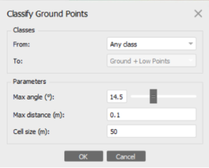
From the Tools menu, select Dense Cloud, then Classify Ground Points…, set the parameters as shown below and click OK.
To generate a DTM, open the Workflow menu and select Build DEM…, click Select. Adjust the parameters referring to the screenshot shown below and click OK then OK again.
-
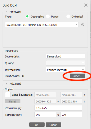
- (Fig. 1) DEM Parameters
-
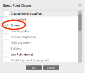
- (Fig. 2) Point Classes Parameters
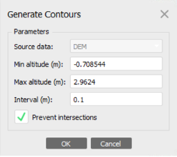
Right-click on the DEM in the Workspace menu and select Create contours…, set the parameters as shown below and click OK.