Geospatial Projections
Jeroen Steenbeek
The Ecospace module of the (EwE) software applies the ecological dynamics of a marine food web across a grid of cells. Traditionally, this grid is geo-referenced to decimal degrees longitude [-180, 180] and latitude [-90, 90], where cells taper at higher latitude ranges – the common WGS84 or EPSG:4326 projection. In its functional groups dispersal calculations Ecospace automatically takes this into account.
To enable environmental driver data input to Ecospace to be mapped to a local UTM spatial projection with highest positional accuracy, these calculations need to be modified.
Re-projecting the UTM data to the traditional Ecospace projection would cause irrevocable changes to driver data since UTM grid cells do not perfectly align nor perfectly overlap with the Ecospace grid. Driver data would thus not arrive in its accurate form in Ecospace, calling for modifications as described in this chapter.
The following changes have been made to the EwE software to satisfy this requirement in three aspects of the EwE source code:
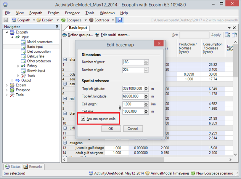
- The Ecospace model has gained an Assume square cells flag. When this flag is turned off, Ecospace will operate in traditional fashion assuming cell tapering by latitude, and assumes that cell coordinates and dimensions are specified in decimal degrees. When turned on, Ecospace assumes that its grid is geo-referenced to a relatively small local area where cells can be considered square, and cells coordinates and dimensions are specified in meters. This required changes to the EwE database format, and changes to Ecospace dispersal computations and sailing cost calculations, which both perform key distance calculations that need to take different geo-spatial projections into account.
- The Ecospace user interface has been adjusted to correctly translate between cell size (stated in projection units) and cell length (stated in km, used for functional group dispersal purposes).
- Ecospace data import and export routines have been adjusted to use the correct map projection units.
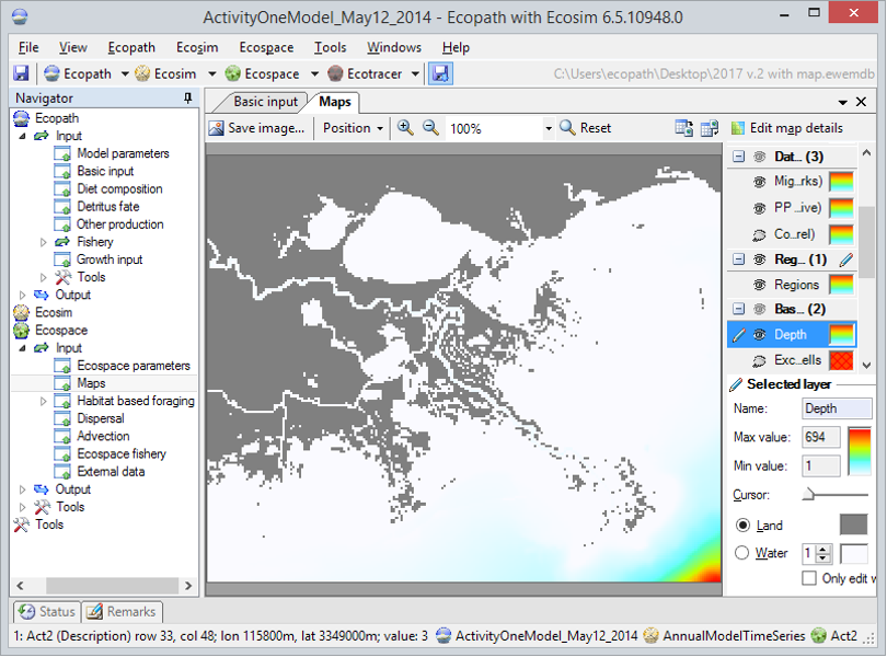
Users can toggle the square cells flag in the Edit Basemap form, found in the Ecospace menu, where map units and the cell length / cell size translations change with the value of the Assume Square Cells flag (Figure 1). The Ecospace map provides correct location feedback to the mouse cursor when hovering over the Ecospace map (Figure 2).