Part 3 – Data Export
Chapter 3.1 – Export Dense Cloud
Overview
This chapter describes the steps to export the Dense Cloud into a variety of external data formats.
Export Dense Cloud
Although Photoscan is competently able to process dense point clouds into 3-D map products, there are also other software packages which are specifically designed to process point clouds (e.g. TerraScan). Dedicated point cloud processing software gives the user access to a wider range of tools with which to manipulate and edit the point cloud in order to produce a variety of architectural and geographic data products.
To facilitate this, Photoscan has an option to export the point cloud into a variety of industry-standard data formats including;
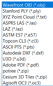
One of the most common and widely used dense cloud data formats is LAS. To export the Dense Cloud, right-click on it in the Workspace and select Export Dense Cloud…. Navigate to where you want to save the data set, enter a name, select a file format and click Save.
The suggested output parameters are shown in the screenshot below, but they may vary depending on the specific software and user requirements.
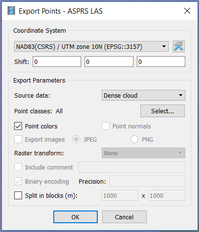
Once the point cloud is exported, it can be opened directly in an external software package.
