Chapter 6. Topographic Maps
Introduction
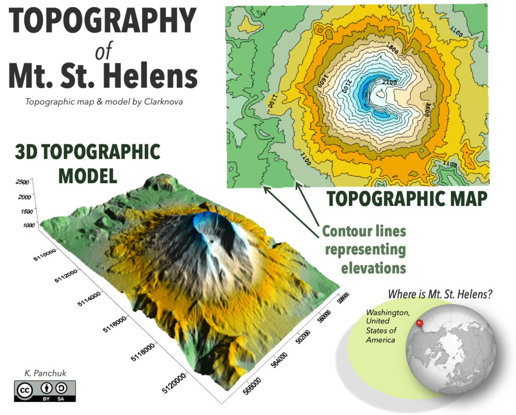
A topographic map is a type of map that adds a vertical dimension to an otherwise two-dimensional map defined by the north, south, east, and west compass directions. This third dimension on a topographic map is represented by contour lines, which represent a constant elevations above either sea level (either average sea level (a.s.l.) or mean sea level (m.s.l.)). A map with such elevation lines gives the map reader detailed information regarding the shape of Earth’s surface, also called its topography.
If you know how to interpret a topographic map, you can locate and identify features on Earth’s surface such as hills, valleys, depressions, steep cliffs and gentle slopes. This information can be applied to important tasks such as identifying areas that may be prone to geologic hazards such as landslides and flooding. Anyone interested in purchasing property, landscaping, planning a hike or camping trip, or who needs to survey an area for construction of a road, dam or building, will want to first consult a topographic map.
Learning Outcomes
After completing this chapter, you should be able to:
• Recognize topographic and geologic patterns
• Read and construct contour lines
• Determine gradients
• Read map scales and convert fractional scales
• Construct a topographic profile
Key Terms
• Bar (graphical) scale
• Benchmarks
• Contour interval
• Contour line
• Equator
• Fractional (ratio) scale
• Gradient
• Hachure marks
• Index contour
• Latitude
• Longitude
• Prime Meridian
• Relief
• Topographic profile
• Verbal scale
• Vertical exaggeration
Attributions
Adapted from:
McBeth, J., Panchuk, K., Prokopiuk, T., Hauber, L., & Lacey, S. (2020). Introductory Physical Geology Laboratory Manual, 1st Canadian Ed., Chapter 7. Topographic Maps by J. McBeth, S. W. Lacey, & T. C. Prokopiuk. CC BY-SA 4.0
Deline, B., Harris. R. & Tefend, K. (2015) Laboratory Manual for Introductory Geology, 1st Edition, Chapter 3. Topographic Maps by K. Tefend & B. Deline. CC BY-SA 4.0
