The Natural Environment of a Population Catchment
The strengthening of rural community resilience is the focus of this book, and a significant part of rural resilience includes rural’s proximity to nature. The population catchment of a rural community is not only defined by the characteristics of the human population, but also sits within a natural catchment that supports all life, both human and non-human. A major part of the transformation going forward is reengaging with nature and living with the natural ecosystems upon which we depend. Though this will be discussed in greater detail in the following chapter, we explore some of the data implications of this transformation here.
Dr. Ilona Hale shares how important our environmental assets are for human health (0:55)
Building on the concept of 1-hr catchments from health facilities, it would be extremely beneficial for health practitioners and decision-makers to understand the characteristics of their community’s natural catchment as well. The data we need to understand this natural catchment includes an understanding of the forest cover, the arable land, the growing season, and optimal crops for the climatic zone of the community. We need to understand the watershed and the seasonal flows, and consider the biodiversity of the areas in which we live, as well as any species at risk. The history of environmental hazards of the catchment needs to be understood in order to form accurate risk management strategies for the communities’ climate adaptation and mitigation. Finally, industrial activity is both an important risk and potential benefit for a rural community, and needs to be optimized to support community sustainability within a broad ecosystem based analysis.
The provincial government and some of the health authorities have made innovative steps to address the need for new and more accessible data. ClimateReadyBC is an example of an initiative that is designed to learn lessons from past emergencies, address disaster and climate risk, build capacity and resilience to face current challenges, and prepare BC communities to mitigate risk from future disasters.29 However, despite the substantial benefits of such data infrastructure, one critical limitation is that the data is not easily accessible at the level of the community catchment, effectively rendering the data ineffective for local change by community members.
Catchment data should be enhanced to include environmental assets and liabilities related to the local population and landscape
Data surrounding food security and water quality are particularly pertinent when considering the effects of climate change and ecosystem disruption. Being able to accurately determine where, when, and how food and water are being accessed and utilized by a rural community can help to assess vulnerabilities and areas for quality improvement. Below, we provide two examples of how different types of data related to food security and water quality might help inform communities and strengthen their resilience.
Food Security
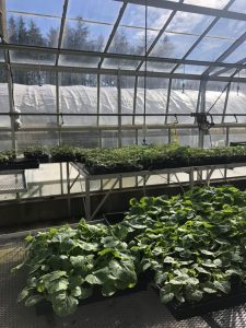
Food security in rural catchments needs to be optimized within a comprehensive plan that minimizes waste, optimizes local food sourcing, and supports vulnerable populations (see Chapter 8, ‘Sustainability’ for a deeper discussion on food security and agriculture). When it comes to data, a study conducted by the Government of Canada in 2021 has identified a need for increased focus on “measuring and monitoring food insecurity within vulnerable populations including rural and remote communities”.30 One way data can support food security is with the use of crop type mapping. Maps of crop type can serve the purpose of “forecasting grain supplies (yield prediction), collecting crop production statistics, facilitating crop rotation records, mapping soil productivity, identification of factors influencing crop stress, assessment of crop damage due to storms and drought, and monitoring farming activity”.31 In BC especially, where food production varies heavily by region, this means of collecting information is an efficient way of identifying region-specific challenges and agricultural best practices.32
Local food management can provide positive economic, social, and environmental effects and significantly reduce the carbon footprint generated by feeding the community. Data that gathers these local innovations can harness rural volunteer spirit and contribute to programs to feed the vulnerable and diminish wastage. For example, Kimberly, BC has created the Healthy Kimberley Program that has had remarkable success in feeding the vulnerable citizens of the community, while the Squamish-Lilloet leadership has inventoried food production in the region and created a Food Assets map that has become a model for other communities.33
Quality of Water
Drinking water advisories alert communities when drinking water is unsafe. These advisories are informed by water quality, which refers to water’s physical, chemical, and biological characteristics.34 The assessment and monitoring of water quality enables the timely detection of environmental issues that may arise from the increase of pollutants resulting from anthropogenic activities.35 In BC, water quality is systematically monitored through the collection of water samples from 48 stations every two to four weeks.36 Data on water quality is then used to:
- track current water quality conditions of rivers;
- track if those conditions are changing over time;
- detect emerging issues that may threaten aquatic life;
- support the development of evidence-based guidelines for water, fish, and sediment;
- track the results of remedial measures and regulatory decisions; and,
- further, improve the network using a risk-based adaptive management approach
Drinking water advisories are issued if water samples detect various contaminants, such as E. coli. In BC, Health Authorities typically announce these water advisories. For instance, Interior Health Authority displays data on water advisories using GIS and has developed an interactive online map that pulls data from the health authority’s internal database system and data from water suppliers in the region to be represented in real-time.37 Different types of water advisories include water quality advisories, boil water notices, and do not consume or use notices. When a ‘do not use’ advisory is issued, residents cannot use the water for anything, as any contact with the known microbial, chemical, or radiological contaminants can be dangerous to the skin, lungs, or eyes.38
For First Nations in Canada, health and water systems (among many others) are managed by various branches of the federal government (i.e., Indigenous Services Canada and Health Canada), and therefore the provincial health authorities in BC are not responsible for issuing advisories for First Nations communities. In 2013, the First Nations Health Authority (FNHA) was established in British Columbia and was able to take responsibility for the programs and services formerly delivered by Health Canada, including the task of testing water quality and issuing advisories when needed.39 Thus, FNHA currently produces monthly summaries of all drinking water advisories among BC First Nations. However, these summaries are not intended for public health messaging, and obtaining up-to-date information on drinking water is carried out by local First Nations Chiefs and Council members.40 In addition to producing these monthly summaries, FNHA also works directly with communities to run drinking water safety programs, which include providing training for community-based water quality monitoring.41
The conventional approach to monitoring water quality requires personnel to take readings from specific instruments to record data and document it, which is time-consuming and costly.42 Environmental engineering researchers are now seeking more innovative techniques for real-time monitoring and water quality assessment. They argue that the health and well-being of individuals are significantly impacted by water contamination, and real-time supervisory systems can identify potential contamination situations earlier on, leading to improved public health.43 These intelligent systems could also notify relevant authorities or personnel of potential hazards, such as high-water levels which can predict impending flooding.44 As water quality becomes threatened by more frequent and intense flooding events, having reliable and accessible data is becoming increasingly crucial for the health and safety of people and wildlife.
Rural population health data should be used to monitor and evaluate the impact of transformation and rural resilience to climate change and ecosystem disruption
Dr. Stefan Grzybowski discusses the data we need to plan future health services (2:44)
