The Geography of BC
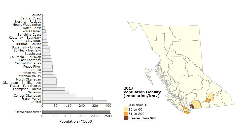
BC, Canada’s westernmost province, has great geographic diversity encompassing Pacific coastal regions and beaches, lush rainforests, deserts, plains, and mountain ranges, which span 75% of its area. With an area of 944,735km2, BC has a landmass roughly the size of France, Germany, and the Netherlands combined.6 Most of the province is covered by wilderness, interspersed with roads and towns (Figure 1). BC has many regions that are rich in agricultural production, including the Fraser Valley, which grows fruits and vegetables, the Okanagan Valley which produces fruits and wine, and the Peace River Valley, which produces abundant grain crops.6 As of 2021, about half of the population of BC resides in the south of the province and 17.8% of BC’s population resides in rural areas.7
A significant portion of rural residents are comprised of Indigenous populations who have lived on the land we call BC for over 10,000 years. There are 198 distinct First Nations in B.C, speaking 30 languages and 60 dialects.8 Most of BC’s land is traditional, ancestral, and unceded Indigenous territory and many rural Indigenous communities rely on the land and natural resources, including the rivers and forests, for not only their livelihoods but also their cultural rites and traditions. This presents unresolved and ongoing issues between government and Indigenous communities as government interests often come into conflict with Indigenous values and beliefs, particularly concerning the protection of natural environments and the lands we live on.9
As climate change progresses and its effects continue to intensify, the natural environment across BC is at serious risk of harm beyond repair. In order to protect precious ecosystems such as forests, rivers, and coastal areas, it is imperative that action is taken to mitigate, adapt to, and build resilience against climate disruption.