Exercise 2.2. Identifying Depositional Environments
What To Do
Use the knowledge you have gained from the lectures and pre-lab exercises to identify the depositional environments on the following aerial images.
Google Earth Options
You can also view and explore locations in this exercise using Google Earth. If you have not used Google Earth, here is your chance to find a lab partner to work with. There are a number of ways to view the locations:
- Use the .kmz file posted on Canvas to navigate to the locations.
- Within Google Earth, search “Inuvik” for Exercise 2.2A, or “Brady Glacier, Alaska” for Exercise 2.2B, then zoom outwards.
- Use the links provided in each question.
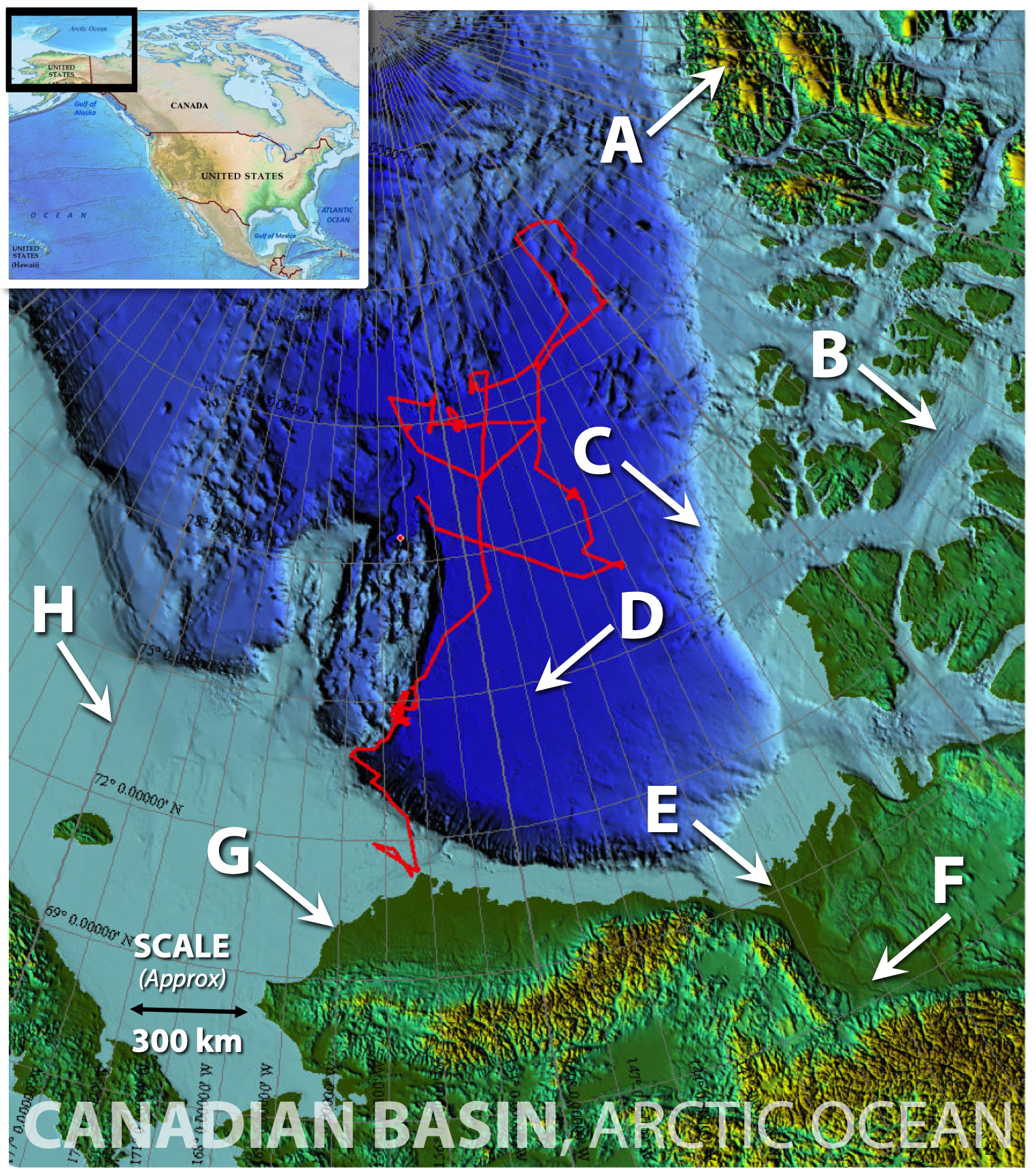
Exercise 2.2A. Canadian Basin, Arctic Ocean
Examine Figure 2.3, which is a combined image showing topographic (green/yellow=land) and bathymetric (blue=ocean) features of part of the Arctic Ocean. Click here to view the location in Google Earth.
Which location (labelled A through H) corresponds to each of the following clastic environments?
- Meandering River: _____
- Delta complex: _____
- Beach: _____
- Shelf (Storm Dominant): _____
- Shelf (Tidal Dominant): _____ Hint: Where might currents be generated by tidal changes in ocean level?
- Continental Slope and Submarine Fans: _____
- Basin floor: _____
- Glacial moraines: _____
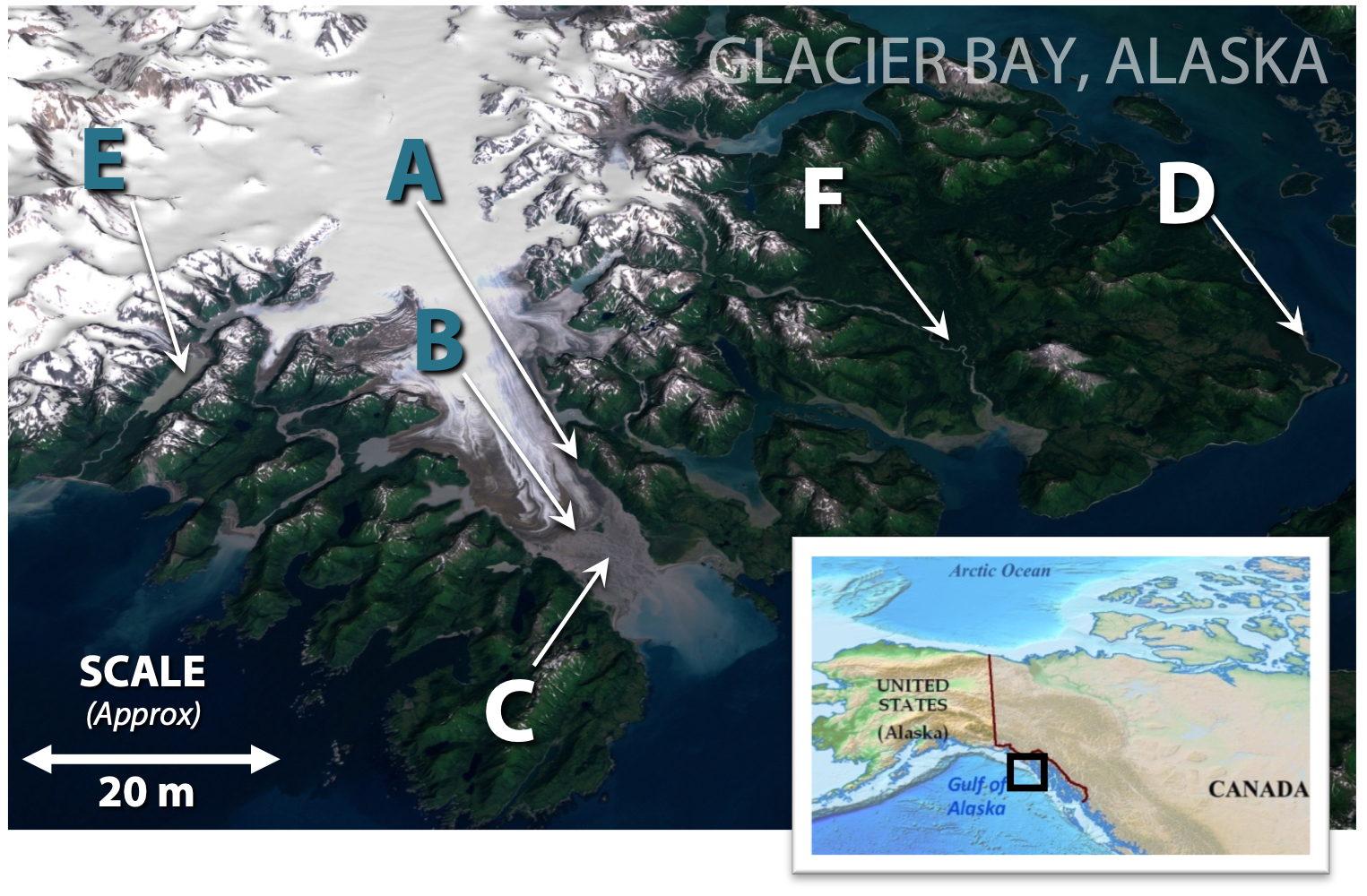
Exercise 2.2B. Glacier Bay, Alaska
Figure 2.4 shows an oblique view of Brady Glacier which is located within Glacier Bay National Park in Alaska. (Click here to view the location in Google Earth.) A number of terrestrial and transitional depositional environments have been labeled with letters on the image.
What depositional environment corresponds to each of letters A through F?
A. _________________________
B. _________________________
C. _________________________
D. _________________________
E. _________________________
F. _________________________
Figures 2.3 and 2.4 are derived from images in the public domain.