Lab 24: South Okanagan Geomorphology Virtual Field Trip
Chani Welch and Todd Redding
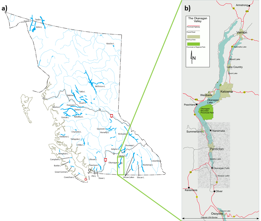
The South Okanagan is generally defined as the portion of the Okanagan Valley from Peachland south to the international border with the USA (Figure 24.1). It is unique in Canada as it has a climate that is relatively dry and warm. However, the South Okanagan has not always had this climate. British Columbia was formed through repeated violent collisions of the Pacific and North American tectonic plates. Volcanic activity, changing climates, and continued tectonic plate movements have all left their mark on the Okanagan Valley.
This lab explores the formation of specific landforms. In doing so, it reviews many of the major geomorphic processes that shape our Earth. Here in the South Okanagan, we visit landscape features that were created by plate tectonics, volcanic activity, weathering, mass movement, fluvial and glacial processes, and often a combination thereof. Welcome to this dynamic area.
Learning Objectives
After completion of this lab, you will be able to:
- Identify the geomorphic process responsible for the formation of landscape features.
- Match theoretical concepts of landscape formation with local examples.
- Use Google Earth to identify landscape features.
Pre-Readings
In order to complete this lab, a theoretical understanding of major geomorphic processes is assumed. It is likely that you have already covered these topics in your geography course. If not, then any introductory physical geography text will explain the major processes of landscape formation. For example, a general introduction to Earth science and geomorphologic processes is contained in Earle (2020) Physical Geology – 2nd Edition. Key areas that you may wish to review are
- plate tectonics, volcanoes, and mountain building,
- faults and geologic cross sections,
- erosional and depositional landforms created by glacier movement,
- weathering and rock slides, and
- watershed hydrology, river types, fluvial landforms.
The location of the South Okanagan is depicted on Figure 24.1.
Lab Exercises
In this lab we will visit ten locations throughout the South Okanagan and discuss their formation. The features were created by plate tectonics, volcanic activity, glacial and fluvial processes, weathering and mass movement.
This lab consists of two exercises and should take 1.5 to 2 hours to complete. The first exercise consists of completing the field trip in Google Earth (Web). In the second exercise you will interpret and reflect on what you have seen and heard in the videos.
EX1: Virtual Field Trip via Google Earth (Web)
The preferred method of completing this field trip is through Google Earth (Web) in order to provide the geographic context for each stop. You are encouraged to take a look around in Google Earth (Web) to familiarize yourself with the area in which the field trip takes place, and put it in context with your understanding or experience of British Columbia specifically, and Canada in general.
Introductory notes for each group of stops and each individual stop are provided below. Individual links to the videos for each field stop are provided with these introductory notes in the event that Google Earth (Web) is inaccessible. Transcript available: [Word] [ODT] [PDF]
In order to access the field trip:
Step 1: Download the Virtual Field Trip [KML file] from Worksheets and save it to a known location on your computer.
Step 2: Open Google Earth (Web).
Step 3: Click on the Projects icon in the menu bar on the left of the screen (placemark in a square).
Step 4: Select New project, then Import KML file from computer. Select the KML file and click Open.
Step 5: The Virtual Field Trip will open. You will see the tour summary in the information panel on the left side of your screen. Click Present to start the tour.
Step 6: Google Earth will zoom you in to the area of the field trip stop. A box will pop up in the top-right corner of your screen with the video. Click the arrow indicating play and watch the video.
Step 7: When you are finished watching the video for the stop, click on the forward > arrow in the bottom-left of the screen to move to the next stop. Note that the view does not change when you transition from Stop 1 to Stop 2 because Stop 2 is already in your view. For remaining stops, you will zoom to the new location. Watch the new video that appears in the top-right corner.
Step 8: Repeat Step 7 until you have completed all 12 stops on the field trip. You can also move through the field trip by expanding the Table of Contents located in the bottom-left of the screen.
Let’s Begin!
Stop 1: Introduction
In Video 24.1 we welcome to this virtual field trip of geomorphology of the South Okanagan.
We respectfully acknowledge that this field trip takes place on the traditional and unceded territory of the Syilx Okanagan people who have taken care of their homelands for thousands of years. To learn more about the Syilx Okanagan people, their homelands, governance, and of special interest to this field trip, their relationship to water, please visit the Syilx Okanagan Nation Alliance website.
Video 24.1. Stop 1. Introduction. Transcript available: [Word] [ODT] [PDF]
Plate Tectonics and Volcanoes
Plate tectonics explains how and why continents can move around Earth, forming and reforming over time. Consequently, it also explains why volcanoes and mountain ranges are located where they are, and why earthquakes occur where they do.
Stop 2: Munson Mountain (Video 24.2)
In order to understand the formation of the Okanagan Valley, we need to begin with the formation of BC. We begin our tour on Munson Mountain, a little-known volcanic feature, and an excellent viewpoint. In Video 24.2 we discuss the accretion of terrains, crustal relaxation, volcanic activity, and the Okanagan Fault, to learn why the valley exists where and as it does.
Video 24.2. Stop 2. Munson Mountain. Transcript available: [Word] [ODT] [PDF]
Glacial Processes
Glaciers have played a major role in shaping the Canadian landscape, and the South Okanagan is no exception. Glaciers are sometimes referred to as natures bulldozers. Glaciers rework the landscape as they advance, creating erosional features with distinctive shapes, and as they retreat, leave behind sediments to create unique depositional features. The presence and orientation of these landscape features are used to interpret the direction and extent of glacier movement.
Stop 3: Giants Head
The shape of Giants Head is the key to understanding how this volcanic remnant we view in Video 24.3 was reshaped by glaciers moving south through the Okanagan Valley. It is one example of a roche moutonnée (literal translation, sheep back). There are many other examples nearby.
Video 24.3. Stop 3. Giants Head. Transcript available: [Word] [ODT] [PDF]
Stop 4: A Glacial Erratic
One definition of erratic is to move in an irregular fashion, at unexpected times, or at the least, to not follow a regular pattern. Appreciate the power of ice and the awesome randomness of glacial deposition on Campbell Mountain in Video 24.4. Note however, that the position of erratics far from their source rocks has been used to understand the movement of glaciers.
Video 24.4. Stop 4. A Glacial Erratic. Transcript available: [Word] [ODT] [PDF]
Stop 5: Till
We don’t see a lot of till in the South Okanagan. We will review the mechanisms for transportation and deposition of the different till types, and learn to tell the difference between basal (lodgement) till and ablation till by inspecting grain size distribution at this outcrop near the Penticton Water Treatment Plant in Video 24.5.
Video 24.5. Stop 5. Till. Transcript available: [Word] [ODT] [PDF]
Stop 6: Glacial Lake Penticton from the Kettle Valley Railway
The Kettle Valley Railway (KVR) once ran from Midway to Hope, with one arm that ran up the east side of Okanagan Lake. The railway ceased to operate in 1961, and has been turned into a multi-use recreational trail. At this stop, we dive back into the icy waters of Glacial Lake Penticton by inspecting glacial lacustrine deposits on the side of the trail.
Video 24.6. Stop 6. Glacial Lake Penticton from the Kettle Valley Railway. Transcript available: [Word] [ODT] [PDF]
Weathering and Mass Movement
Weathering is the breakdown of rock. Mass movement is the downslope movement of rock and/or sediments. Time scale is critical to understanding the rates of these processes.
Stop 7: Weathering
In the hills above Penticton, investigate different ways that water, vegetation, and time break down rock in Video 24.7.
Video 24.7. Stop 7. Weathering. Transcript available: [Word] [ODT] [PDF]
Stop 8: Summerland Rock Slide 2019.
In early February, 2019, Highway 97C was closed north of Summerland for 10 days by a rockslide. A motorist present captured the major rockfall on camera from the safety of their car. Rock slides in this area are not uncommon due to multiple small faults in the rock. Watch the action and join UBC Okanagan engineering professor Dwayne Tannant for an assessment mid-way through the drama. Ultimately, approximately 20,000 m3 of rock was removed from the site over the following months. Monitoring of slope movement continues.
To access this field trip stop, read the local news article Slope still posing a threat and watch the video included in the article.
Transcript available: [Word] [ODT] [PDF]
Fluvial Processes
Fluvial processes have dominated geomorphic change since the last glaciation. As with glaciers, fluvial systems both erode and deposit material, creating erosional and depositional landforms. A critical difference between glaciers and rivers in terms of deposition, is that rivers sort material based on weight (grain size), whereas glaciers do not.
Stop 9: Why Penticton Is Located Where It Is
Perched high above the valley bottom, we look down at the City of Penticton in Video 24.8, and learn how the coincidental discharge of three fluvial systems at this one narrow point in Okanagan Lake led to the formation of the alluvial fan delta on which Penticton is located. This feature separates Okanagan Lake and Skaha Lake.
Video 24.8. Stop 9. Why Penticton Is Located Where It Is. Transcript available: [Word] [ODT] [PDF]
Stop 10: Penticton Dam and The Channel
In Video 24.9 we will explore the hydrology of the South Okanagan, including the drastic changes to the Okanagan River in the past 70 years. We will also learn how to identify historical floodplain features in current images.
Video 24.9. Stop 10. Penticton Dam and The Channel. Transcript available: [Word] [ODT] [PDF]
Stop 11: White Lake Formation
Take a trip back in time to the Eocene through the lens of the White Lake Formation rocks in Video 24.10 and experience a warmer, wetter climate and large paleoriver systems dominating the Okanagan.
Video 24.10. Stop 11. White Lake Formation. Transcript available: [Word] [ODT] [PDF]
And finally…
Stop 12: Wrap Up
Thank you for joining the virtual field trip. Here in Video 24.11 we summarize the processes that created the Okanagan Valley as we see it today.
Video 24.11. Stop 12. Wrap Up. Transcript available: [Word] [ODT] [PDF]
EX2: Interpret What You Have Seen and Learned
Plate Tectonics and Volcanoes
- Munson Mountain slid to the west when the Okanagan Fault activated. Is the magma chamber related to Munson Mountain likely to sit directly below it? If not, where is it likely to be?
- In which general direction does the Okanagan Fault run in the South Okanagan?
- The types of rocks located west and east of Okanagan Lake are markedly different. Name the two different major rock types and describe their formation in geologic terms.
- Sketch a cross section of the Okanagan Valley immediately north of Penticton as it would have been prior to glaciation. Label the major rock types, direction of movement along the fault plane, fault type and features (hanging wall, footwall).
Glacial Processes
- Sketch the general shape of a roche moutonnée. Indicate the direction of ice movement, and the locations of glacial polishing and glacial plucking. Name and describe the process of glacial erosion involved.
- Glacial erratics are depositional features of post-glacial landscapes.
- Did the glacial erratic originate on Campbell Mountain?
- Was it deposited as glaciers advanced or retreated?
- Two types of till are visible near the Penticton Water Treatment Plant. Name the two types and describe how glaciers transport and deposit each.
- In which direction did Glacial Lake Penticton drain? Why?
- What evidence is there that there was an ice core in the middle of Glacial Lake Penticton?
- Would you build a house on the silt cliffs? Why/why not?
Weathering and Mass Movement
- At the start of the Stop 7: Weathering video, Todd describes a type of weathering that involves the growth of a tree. What type of weathering is this? Provide an example of where this occurs in urban environments.
- In colder environments physical processes tend to dominate weathering. Describe the process by which water freezing and thawing weathers rock.
- Todd loves geomorphology but is a little camera-shy. How many times did he say um, ah, err in the weathering video? (This question was his idea.)
- The Summerland Rock Slide was rather inconvenient for people wishing to travel between Penticton and Kelowna.
- What was the largest estimate of moving rock (in m3)? Is this a large volume in comparison to other mass movement events in Canadian history?
- Did the rockslide happen all at once?
- How was the rockslide stabilized?
Fluvial Processes
- What are the names of the three streams that have deposited sediment to create the ground on which Penticton is located?
- Why is the feature that Penticton is located on called a fan-delta (specifically a coalescing fan-delta)?
- Is modern Okanagan Lake a completely natural feature? Explain.
- What type of river was the Okanagan River before it was channelized?
- Describe one benefit and one drawback of the dam and channelization. Is it possible to reconcile the two?
- Describe the difference between an oxbow lake and a meander scar. Are these natural or man-made floodplain features?
- What evidence is there that the climate was warmer and wetter when the paleoriver system that deposited the White Lake Formation was flowing?
- Explain why high energy flow regimes deposit coarse sediments and low energy flow regimes deposit fine sediments.
Overview
- Sketch a modern cross section of the Okanagan Valley immediately north of Penticton. Label the major rock types and the major deposits since the Pleistocene.
Reflection Questions
- Here are the coordinates for three additional landforms in the South Okanagan. Can you identify what they are, and how and when (pre or post the last glaciation) they were formed? Enter the coordinates into Google Earth (Web) to take yourself there.
- Feature 1: 49°34’19”N and 119°37’58”W (coordinates are in the centre of the feature).
- Features 2 and 3: 49°16’09”N and 119°32’00”W (coordinates sit between the two features (same type)).
- Using Google Earth, zoom to your area (or an area of interest) in BC. Identify a landscape feature of interest to you. Provide the coordinates. Describe how and when this feature was formed. It may be useful to switch into 3D mode as some features are easier to interpret from a side view rather than a birds-eye view.
- As discussed on the tour, the major agents for geomorphic change in an area change with time. Volcanoes, glaciers, and fluvial systems have all dominated at different times in the South Okanagan. Many scientists believe that we are now in a new epoch called the Anthropocene. What do you think the major agent for geomorphic change is today? What is your evidence for this? Consider, for example, what you see at 49°28’07”N and 119°33’49”W.
Worksheets
References
Earle, S. 2020. Physical geology, 2nd Edition. BCcampus. https://opentextbc.ca/physicalgeology2ed/
Roed, MA and Fulton, RJ (eds), 2011. Okanagan geology south, Kelowna, BC. Okanagan Geology Committee.
